Sitting in the office at Acadia University
in Wolfville Nova Scotia, TAG scientists in California emailed that a MiniPAT
pop-up satellite archival tag, that had been previously outfitted on a bluefin tuna, recently popped up just 5km offshore of Cape Breton in the Gulf of St.
Lawrence. When this tag popped up it transmitted some of the data it had
recorded since being placed on the tuna, but by retrieving the tag a whole
suite of archived data – basically a complete record of the tuna’s activity
since being tagged – could be collected. So with this tag popping up so close
to the coast, retrieving it was worth a shot!
Once popped up, these tags begin to
transmit their location to satellites which then pass the information along to
the scientists who own the tags. With the location data coming in from the tag,
going out to get it sounds easy enough, but in reality, spotting a tiny black
ball with an antenna on top just floating along in the open ocean is no easy
task.
With winds high on Friday and starting back
up again Sunday, Saturday was our only opportunity of getting calm enough
waters to have a chance at spotting the tag before it got caught in the current
and was swept too far off shore for retrieval.
Friday afternoon, Dr. Aaron Spares, part of
the coastal ecology lab at Acadia University, and I, a Master’s student, packed
up and began the trip to Margaree Harbour in Cape Breton to meet John Lauchlin,
the captain of ‘Keepin’ Tradition’. We arrived late Friday night and after a quick
trip to the wharf it was right to bed to rest our eyes and prepare for an early
morning start. Just before sunrise we set out to the last transmitted location
which was about 5km off of Cheticamp Island. We could not have picked a better
day; the waters were flat calm as the sun rose over the highlands and as we got
closer to our location our eyes were peeled and ready to spot that tag.
 |
| Sunrise over the Cape Breton Highlands |
Once at the last known tag location, we
turned on the tag locator, which can pick up the transmissions from the tag and
help us narrow in on the exact location. The tag locator measures the distance
between you and the tag and uses a scale from 0 to 237 to tell you how close
you are, with 0 being the farthest and 237 the closest. It’s like a big game of
hot and cold and based on the numbers that the locator gives you, you choose
which direction to head.
We received our first transmission from the
tag as soon as we turned on the locator. With Aaron and I both relatively new
with this equipment, as soon as we received a transmission we decided to start
corkscrewing around that location to narrow in on the tag. After about an hour
of this, with no head way, we realized that the range of tag reception must be
larger than we first thought and we might be much farther away than expected.
We decided to take the path of strongest reception and drive until we got
significantly higher numbers. Reaching what we assumed to be a much stronger
signal we began to slow down and narrow our search again only to run into the
same problem. After another hour or so, we still weren’t any closer. As this
point, a little bit frustrated, we chose the path of the last strong signal and
headed in that direction until we got to almost max signal strength before we
slowed down. By some luck – or our captain’s expert navigation skills – it
seemed like once we picked a direction, that he basically drove directly to the
tag!
 |
| Tag in the water |
Upon reaching 237 (the strongest signal on
the tag locator) we slowed right down and there it was, bobbing along just a
few meters from the starboard side. Aaron noticed it about a second before I
did and as we both kept an eye on it John pulled the boat right up beside it,
grabbed the dip net, and just like that, we had the tag! After hours of what
seemed like aimless and frustrating searching, it was all smiles, mixed
feelings of excitement and relief, aboard the ‘Keepin’ Tradition’.
 |
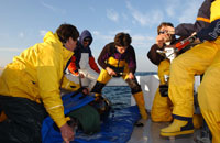
John
Lauchlin and Danni Harper happy to have found the tag
|
With the work done, Aaron and I sat on the
bow as we steamed back to the wharf. The perfect weather seemed to bring
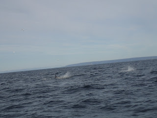
everyone out on that beautiful Saturday morning. With a couple fin whales off
the stern, a pod of pilot whales off the starboard side, and grey seals playing
off the bow. It really was the perfect day on the water and Aaron and I took in
every last bit of it before we had to make our way back on land.
Having finished up earlier than expected,
we decided to stop in at Port Hood to visit some long time TAG team members en-route
back to Acadia. Upon arriving at the wharf, Dennis Cameron, the fisherman who
assists with tuna tagging, informed us of some exciting news. There were a
couple of fishermen on their way back in with a tuna that was outfitted with a
satellite tag! We couldn’t believe it, what were the chances, two tags in one
day! And for me, having never seen a Bluefin tuna in real life, I was pretty
excited.
As news of the tagged tuna spread, the
wharf got busy, and so did Dennis who was in scattered communications with TAG’s
Barb Block and Robbie Schallert in California about what to do about the tag
and what samples to get from the tuna.
 |
| Tags on the tuna |
Once the tuna arrived at the docks it was
brought up and sure enough, securely attached beside the dorsal fins were a
pop-up satellite tag and an acoustic tag. Everyone on the wharf was so
interested in the tags and it was a great experience to share with them what
the tags were, how they worked, and what information the scientists were
getting from them.
 |
| Fisherman checking out the satellite tag |
The tags and tethers were taken off the
tuna and then it was into the ice house to be dressed. Dennis collected a variety
of samples (muscle, liver, and ear bones called otoliths) that will provide
great information coupled with the tracking data from the tags.
With the fish on ice, the excitement died
down and Aaron and I parted ways with the crew in Port Hood to continue our
scenic drive through Nova Scotia from the Cape Breton Highlands back to Acadia
University.
-Danni Harper


